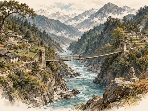
Anjaw, the Lohit valley and the discipline of border-region research. Updated 8 October 2026 from the 22 September brief.
Walong is both a living civilian place and a site of public remembrance of the 1962 war. A useful regional report should make space for both. The existing brief is strongest where it separates official administrative facts, dated census evidence, environmental context and unresolved place-name questions.
The source began with a schematic image labelled Walong Sector. It did not provide a measurable study boundary. This website edition retains the civilian regional frame and the provenance limits rather than turning the drawing into a current operational map.
What can be established now
The Anjaw district administration identifies Walong as a circle headquarters and describes its war memorial and 1962 history. The district was separated from Lohit on 16 February 2004, with Hawai as headquarters. Its administrative account records eight circles and four community-development blocks. Those are different geographic units. Walong page · District account.
The current official event page announces the 64th Walong Day programme for 27 October–16 November 2026. As of this review, those are scheduled commemorative events, not completed attendance or economic-impact results. The page was updated on 7 October. Official 2026 notice.
The event provides a timely public-interest reason to publish the article. It does not change the reference year of the population statistics or establish that every listed local service is operating today.
Figure 01 · Conceptual framework
Build a regional claim from the right evidence
A dated statistical baseline is better than a false current estimate
The original report inspected the official 2011 Anjaw District Census Handbook. The values below refer to the district at that census, not Walong village or an estimated 2026 population. The handbook’s later upload date does not update its survey year. Official handbook.
| Indicator | Anjaw Census 2011 value |
|---|---|
| Area | 6,190 square kilometres |
| Population | 21,167 |
| Rural population | 20,185 |
| Urban population | 982 |
| Literacy, age seven and above | 56.46% |
| Scheduled Tribe share | 77.72% |
| Villages | 305 total; 278 inhabited; 27 uninhabited |
The source also records 11,507 males and 9,660 females and a sex ratio of 839 females per 1,000 males. These are consistent census descriptors, not evidence about current demographic change. No new population estimate was located and adopted in this refresh.
The district account identifies Tawrah/Digaru Mishmi, Kaman/Miju Mishmi and Meyor communities. The original brief also draws on Tadu Rimi’s 2025 fieldwork study of the Meyors. Qualitative accounts help explain memory and identity, but disputed labels and oral histories should remain attributed rather than being converted into a precise new population count.
The map establishes a question, not a measured area
The inspected source TIFF was 1,500 by 2,400 pixels and explicitly marked not to scale. The original inspection found no coordinate grid, explicit north arrow or standard GeoTIFF reference tags. Its Photoshop metadata timestamp is a file property, not a verified survey date.
A 180-degree arc still needs a centre, radius or outer boundary, and orientation. Without those, there is no reproducible study area. Measuring distance from the drawing or assuming its top is true north would manufacture precision.
This matters beyond cartography. Population, rainfall and service statistics can be assigned to the wrong area if the boundary is not established first. An attractive map should never conceal that administrative, physical and cultural regions can differ.
Figure 02 · Qualitative comparison
Read resilience through everyday services
| Lens | Research question |
|---|---|
| People | Which needs and services are documented? |
| Connections | What access is supported by public evidence? |
| Environment | Are data local, seasonal or state-wide? |
| Institutions | Who owns the relevant public information? |
Historical names need an evidence chain
The brief found the name Rima in a 1911 UK parliamentary record. That is evidence of historical usage, not a verified match to a modern gazetteer entry. The label Tatu remained unresolved. This edition does not turn repeated spellings or unsourced online equivalences into a modern location.
A future place-name resolution should state the original spelling, language, record date, modern candidate and evidence linking them. Historical territorial language should remain in its period context. It should not determine present sovereignty or a current boundary.
Environment: separate state normals from local conditions
The original report reviewed IMD’s 1989–2018 rainfall analysis. It gives Arunachal Pradesh an annual mean of 2,741.6 mm, with 1,762.3 mm during June–September, or approximately 64.3%. These are state-level historical averages, not observations from a Walong station and not a forecast for the upcoming events. IMD study.
The source’s monthly state means are 485.6 mm in June, 526.8 in July, 389.0 in August and 360.9 in September. Their sum reproduces the monsoon total. They can explain why seasonal conditions matter, but they should not be used to determine whether a specific road, slope or event is safe on a particular day.
The source discusses earthquakes, floods, flash floods, landslides and fire using the state’s disaster-management material. Such broad screening is not a site-specific engineering probability. A current local assessment would need observations, warnings and responsible local authorities’ information. None is inferred from the historical dataset.
Figure 03 · Conceptual framework
From remembered name to defensible identification
Civilian resilience broadens the security lens
The agricultural account in the original brief describes paddy, maize, vegetables and large cardamom, together with erosion and rainfall-related constraints. Its production tables lacked a clear reference year, so this edition publishes no invented 2026 output or yield.
The public-policy questions are practical: can households access services reliably, can livelihoods adapt to seasonal constraints, is local knowledge represented, and are historical and cultural accounts handled accurately? These questions complement remembrance and strategic geography. They do not require compiling current military deployments or patrol information.
For a community or heritage publication, the strongest supporting diagram is an evidence map: district administration for present administrative identity, census for dated statistical baseline, IMD for state historical climate and primary historical records for old names. Each source contributes within its own boundary.
Research gaps that remain open
The original brief did not establish a precise cross-border study arc, a modern identity for Tatu, a dependable modern equivalence for Rima, a current local population, a Walong weather-station series or live facilities availability. Those gaps are retained. A newly updated web page cannot by itself supply the missing measurements.
The result is a publishable regional article with a current commemorative anchor and an explicit evidence standard. Its credibility comes from knowing what each source establishes, not from giving every blank cell an apparently precise answer.