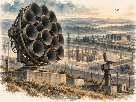
Expanded from the reading guide prepared on 25 September 2026; reviewed 8 October 2026. The source is a linked catalogue, not a recovered long-form Arctic research report. This edition adds an original strategic synthesis grounded in its themes and checked primary material. It does not imply that every subscriber article in the catalogue was read in full.
Greenland and the wider Arctic combine several different questions: defense access, alliance coordination, shipping reliability, mineral development, communications, environmental change and the interests of local communities. A map can place them in one frame, but it cannot make them one economic or military variable. Good analysis separates the decisions before asking where they interact.
What the existing research collection contains
The original guide contains 50 Bloomberg items: 43 on the Arctic and Greenland and seven on Antarctica. These are counts within the user’s catalogue, not a claim to cover the complete publisher archive. The guide records articles, graphics, opinion pieces, videos and photograph-led features separately, with item-level verification codes.
The closest recovered match to the remembered military map is the item dated 13 March 2023, labelled “Arming the Arctic” in the guide. That identification remains a strong candidate, not a confirmed memory match. A 2023 map should be treated as a historical editorial depiction, not a current military deployment map.
The guide also distinguishes exact dates from year-only entries and publisher text from index or cross-reference verification. Those details should survive publication. They explain what the research actually recovered and prevent an attractive reading list from becoming an overstated evidence base.
The current primary-source anchor
NATO announced Arctic Sentry on 11 February 2026, describing a multi-domain activity led by Joint Force Command Norfolk and bringing Allied activities into an overarching approach. The announcement identifies alliance coordination and operating in Arctic conditions as central concerns. NATO announcement.
That is a verified institutional development. It does not establish the current availability of every asset shown in a media map, resolve sovereignty questions, or validate the economics of a particular mineral or shipping project. The analytical value is that coordination, visibility and sustained operation have become explicit parts of the alliance framework.
The source guide’s 2026 media entries can now be read against that official anchor. The article keeps the policy development distinct from the publisher’s interpretation and from the commercial expectations of investors.
Figure 01 · Qualitative comparison
Four decisions hiding inside one map
| Decision | Evidence needed |
|---|---|
| Authority | Law, governance and community interests |
| Access | Agreements and practical support |
| Minerals | Project economics and execution evidence |
| Shipping | Whole-route cost, reliability and support |
Four decisions that should not be collapsed
| Question | Evidence needed | Common analytical mistake |
|---|---|---|
| Can forces and civilian services operate reliably? | Sustained logistics, communications, maintenance and access | Counting platforms without the support system |
| Is a shipping route commercially useful? | Seasonal reliability, vessel suitability, insurance and end-to-end costs | Treating a shorter line on a map as lower delivered cost |
| Can a resource become saleable production? | Permits, infrastructure, finance, processing and offtake | Treating geological presence as a producing asset |
| Does a project create durable local value? | Community participation, services, employment and environmental evidence | Treating local consequences as a footnote |
These are decision frameworks developed from the catalogue’s recurring topics. They are not current project valuations. Each can reach a different conclusion: a location can matter strategically even when a mine is uneconomic; a route can be technically traversable without being dependable for a scheduled service.
Geography creates options and obligations
Arctic distance and climate make supporting infrastructure central to any assessment. A base, port or runway is useful through the services it can sustain. Maintenance, trained personnel, energy, communications and reliable access are part of the capability, not peripheral costs.
The same principle applies to civilian infrastructure. A digital link can have strategic significance because it connects government services, businesses and communities. Redundancy should be assessed across shore facilities and inland connections as well as the cable itself. This connects the Arctic reading programme with the separate Deep Seabed Security research without counting either as an additional source report.
A portfolio of projects should be tested for common dependencies. Several proposals can rely on the same scarce construction capacity, seasonal access window or public funding envelope. Adding their announced values together can obscure competition for the resource that makes them feasible.
Figure 02 · Conceptual framework
A mineral resource is not yet a cash flow
Mineral optionality is not a discounted cash-flow result
The guide contains several Greenland resource and investment stories. The correct next analytical step is to identify the project’s stage and commercial chain. Geological resource, reserve, licence, financed development and producing capacity are different categories.
A valuation requires assumptions about recoverable output, processing, transport, power, environmental obligations, capital cost, operating cost, time and sales terms. If the chain depends on infrastructure that is not yet financed, that dependency belongs inside the scenario, rather than being assumed available for free.
Strategic interest may change the financing environment, but it does not abolish execution risk. A government can rationally support a project for supply resilience even when its standalone commercial return is weaker. The public cost and the intended resilience benefit should then be stated separately.
This edition publishes no new resource-volume or mine-valuation number because none was independently established during the refresh. That is a deliberate evidentiary boundary, not an assumption that the underlying projects lack value.
Shipping should be compared end to end
A route comparison needs origin and destination, season, cargo, vessel class, speed assumptions, insurance, escort requirements where applicable, port charges and expected delay. A distance saving can be offset by restricted timing or unreliable delivery. A container service and a specialised bulk movement have different economics.
The relevant measure is delivered cost and reliability under the conditions faced by the user. For supply chains, variability can matter more than the average sailing time. A route that works in a favourable season may still require backup inventory or an alternative service for the rest of the year.
No live route advice or claimed 2026 traffic series is supplied here. The purpose is to improve how the original shipping articles are read and compared.
Figure 03 · Qualitative comparison
Compare the whole journey
| Dimension | Decision implication |
|---|---|
| Distance | Travel savings are conditional |
| Reliability | Delays can outweigh distance savings |
| Support | Availability limits practical service |
| Economics | Compare total delivered cost |
A practical reading sequence
Start with the guide’s military-geography entries to understand the spatial frame, then read the 2026 NATO announcement to establish the institutional change. Next, compare the Greenland minerals articles with project-stage evidence, and the shipping articles with complete voyage economics. Finish with community and climate reporting so that operating assumptions are not detached from local conditions.
Retain an evidence note for each item: what was read, who published it, observation period, publication date, format, access limit and the decision it informs. Opinion can illuminate a trade-off; a primary announcement can establish an official act; neither replaces the other.
The seven Antarctica entries remain in the original catalogue as a separate reading extension. They are not treated as evidence about Arctic rivalry or Greenland policy.
The strategic judgement
The region should be understood as a set of interacting systems whose usefulness depends on sustained operation. Maps reveal location; procurement and investment analysis reveal whether the intended service can be delivered. The combined article’s value is to connect those two forms of reasoning while preserving the original guide’s verification limits.